BuiltWithNOF

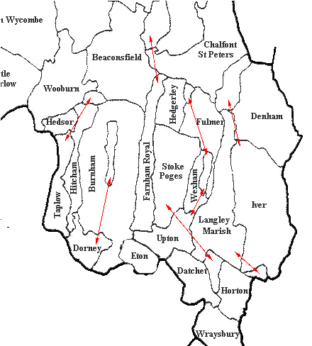
Parish Map

1770_HITCHAM_BOUNDARY-bw_web

Contains Ordnance Survey data

© Crown copyright 2024

bucks_parish_boundaries

Hitcham Parish may be a strange shape, but unlike other local parishes it is at least one single area! Parishes were often designed to provide a complete range of farming opportunities - chalk hills, marshes and access to a river. Borders defined the limits of a parish’s income and were jealously guarded.

[Home] [About this site] [Contact Us] [Documents] [Misc papers] [Rectors] [Church plan] [Glebe Land] [Parish Map] [Photo gallery] [Monuments] [War Memorial] [Sanctus bell] [Heraldry 1] [Heraldry 2] [Hatchments 1] [Hatchments 2] [Hatchments 3] [Links]